Wyalusing State Park Mounds
(Wyalusing State Park Mounds Archeological District)
National Register of Historic Places
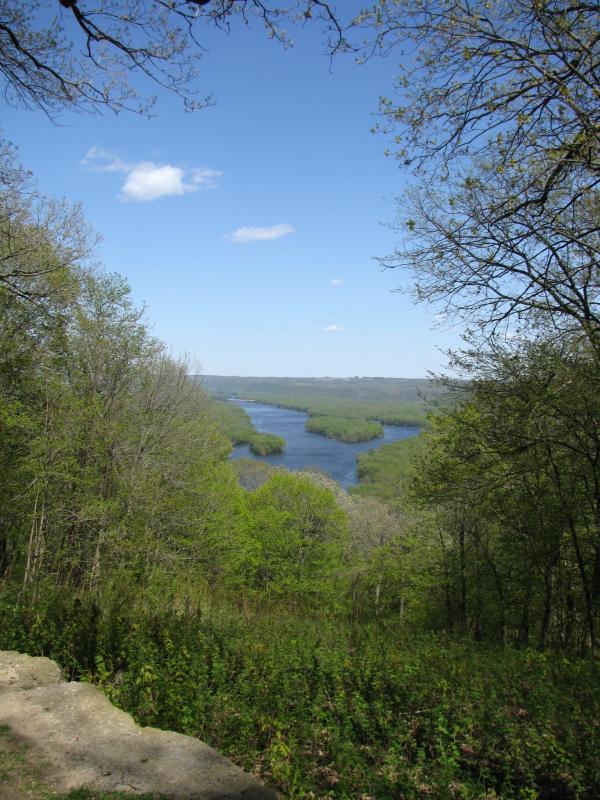
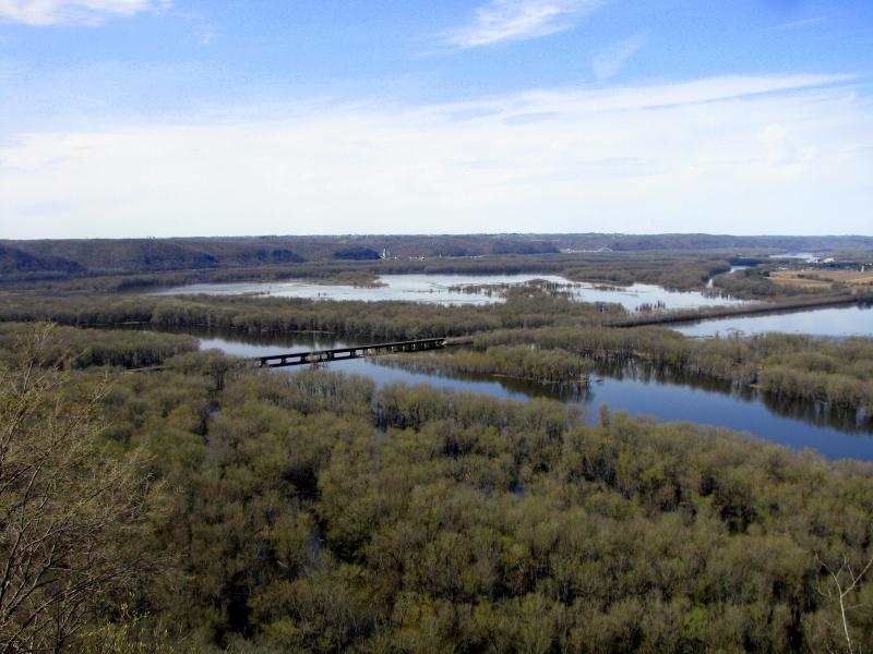
Wyalusing State Park, thanks to its unique location at the confluence or Wisconsin River and Mississippi, was a hub of activity for
the prehistoric Woodland culture. Not surprisingly, large number of mounds were built here, and quite a few of them survive to this
day. I was able to explore only few groups of mounds mentioned on the official maps of the park.
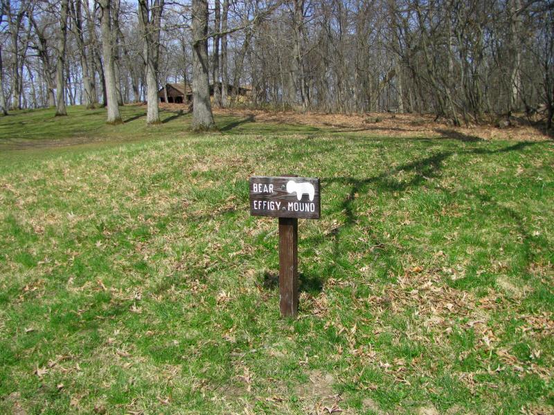
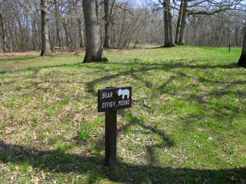
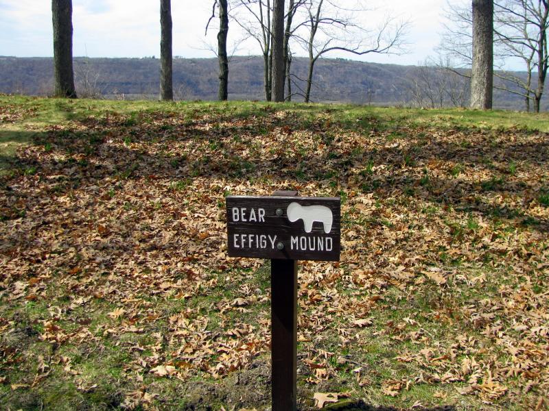
Two bear effigies are located by the ball field next to the main picnic area and nature center at Council point. Mounds are marked,
but located in busy area and are subject to heavy pedestrian traffic and mowing (above). I believe decorative fencing should
be put around the effigies to prevent further damage.
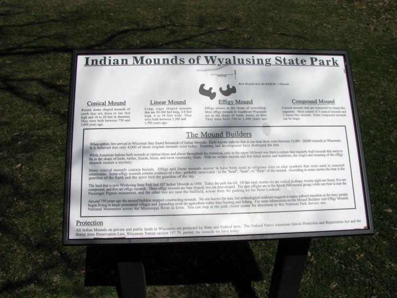
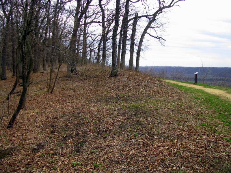
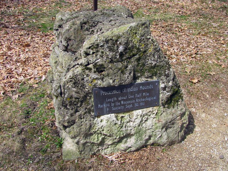
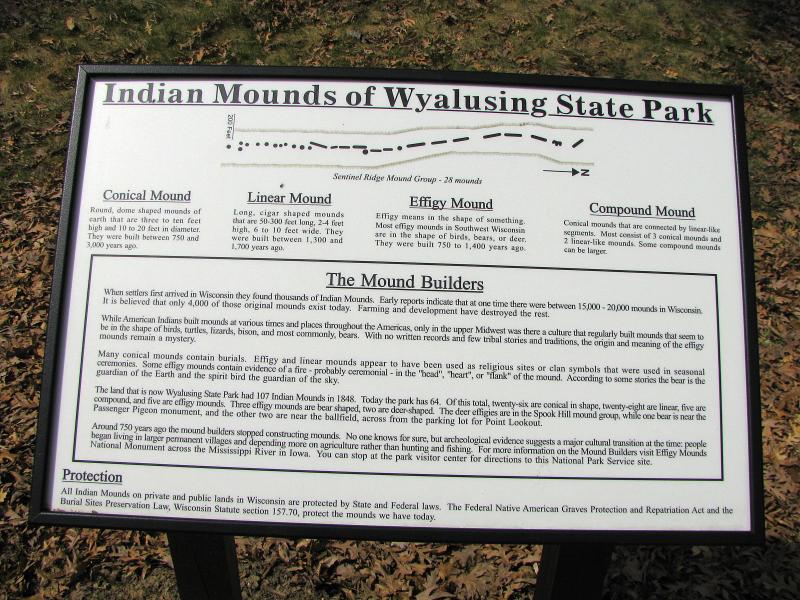
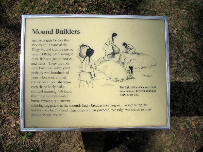
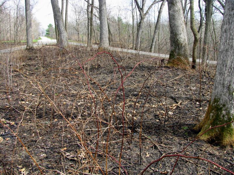
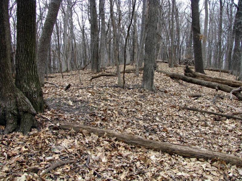
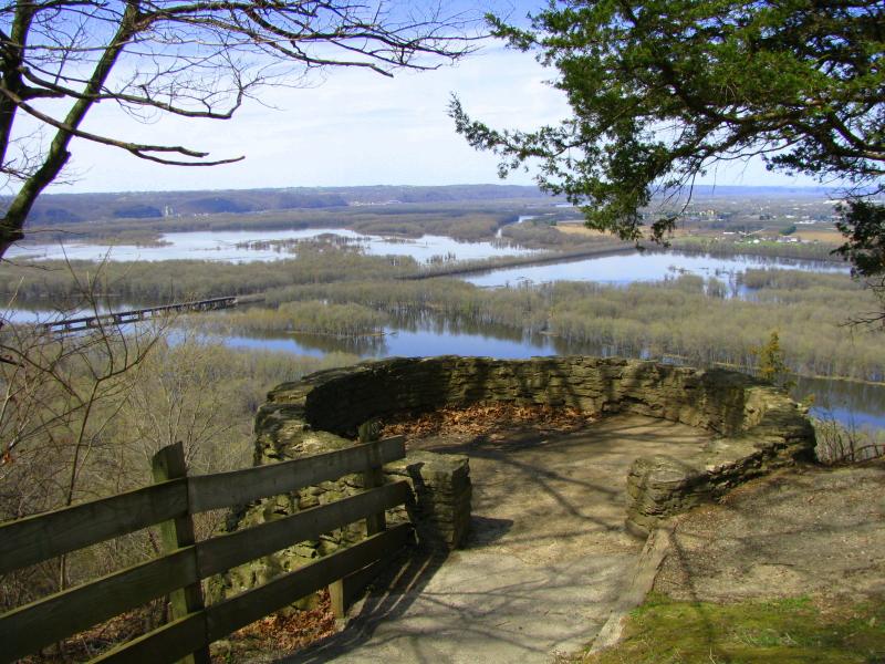
The best known cluster of mounds in the park is probably Sentinel Ridge Mound Group, comprised of 28 effigy, linear and conical
mounds. Some are marked, some aren't. This group is also known as Signal Hill Mound Group. To confuse the matter, the next group
over, called Procession of the Mounds, is also comprised of 28 mounds (effigy, linear and conical), and pretty much continues the former. While no pedestrian traffic affects the site, trees growing over the body of the mounds could be a bigger problem in a location like this
than elsewhere - the site is on top of the bluff and completely exposed to storms coming from west. It's only a matter of time before
some trees are toppled, taking the fabric of mounds with them (see above).
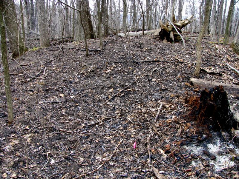
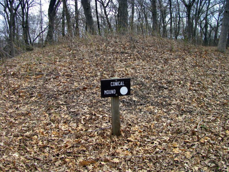
The other grouping of mounds is in the woods behind the Indoor Group Camp. There is no easy access to the site, so I only explored
one mound there. The story it told me was that the group is covered in trees, shrubs and fallen tree trunks and debris - no good (above
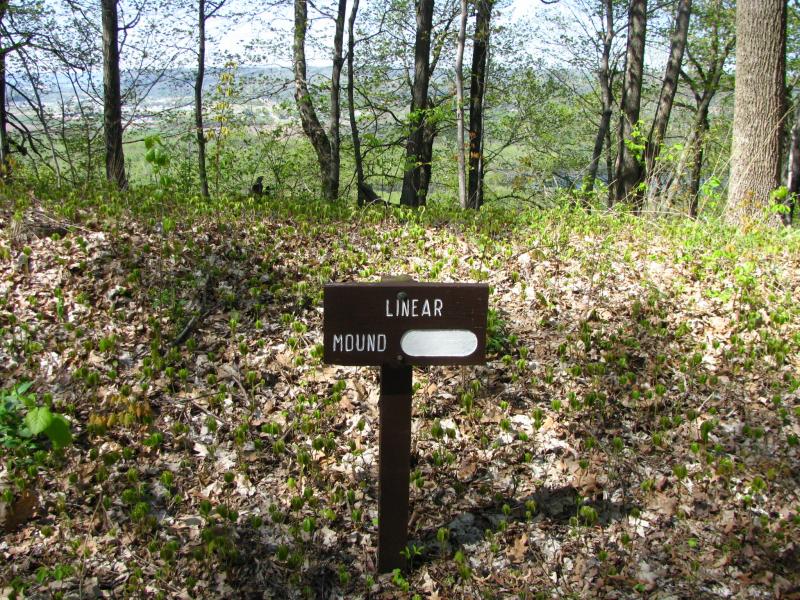
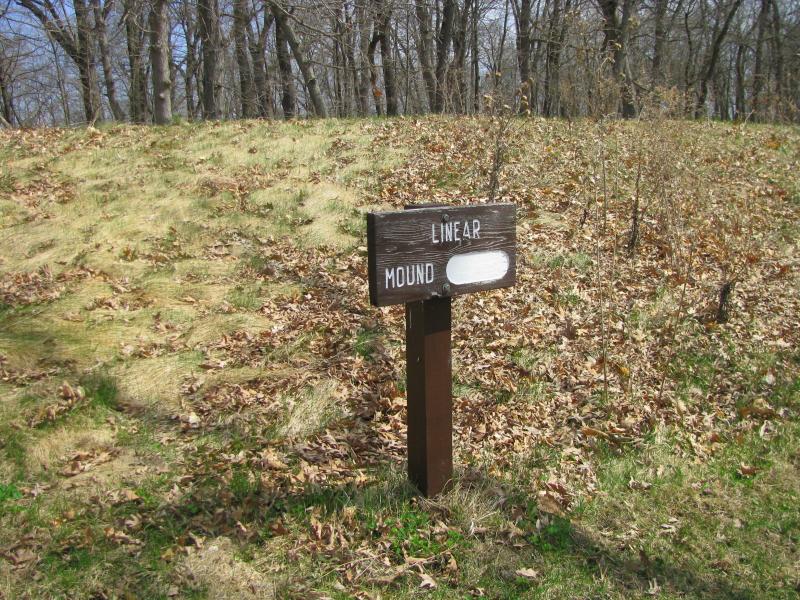
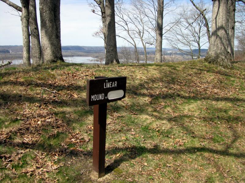
left). On the other hand, there is a single linear mound at the easternmost tip of the Wisconsin Ridge Campground on a bluff facing
Wisconsin River - it's marked and in good shape (above center and right).
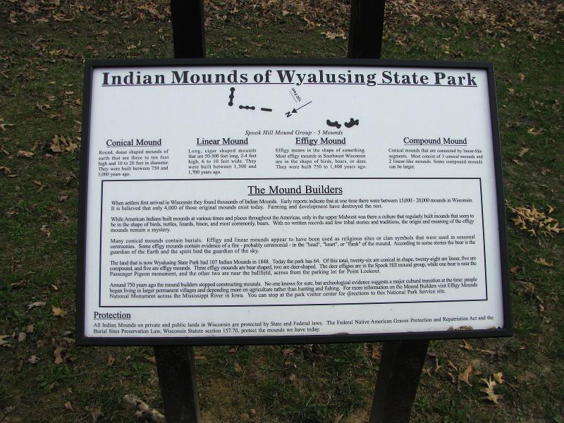
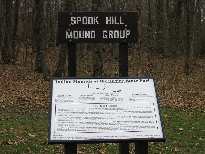
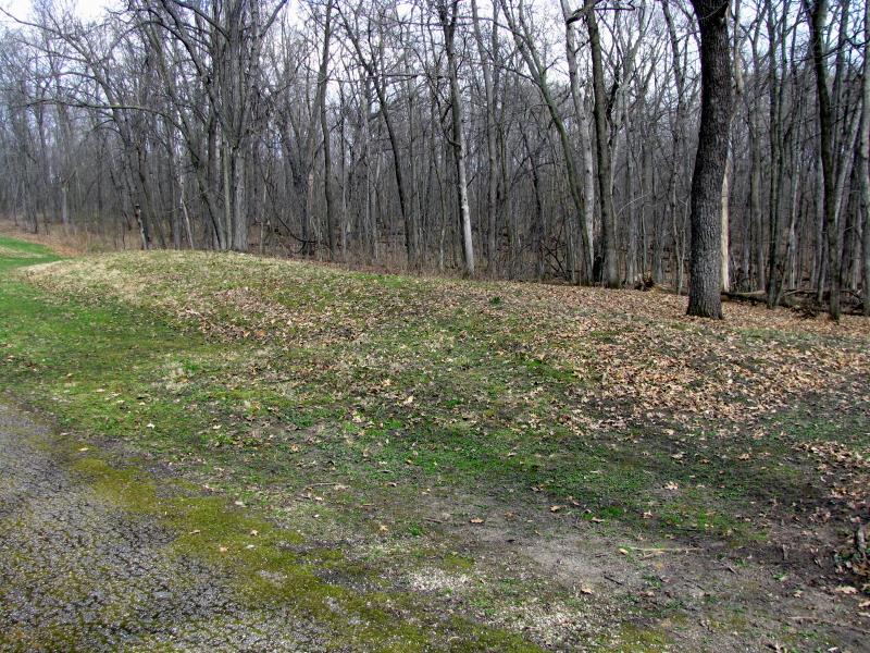
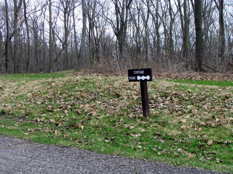
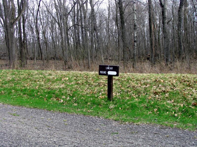
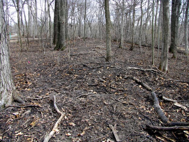
The last group I surveyed is called Spook Hill Mounds and is located on Cathedral Tree Drive. The group consists of 5 mounds -
2 compound (chain) mounds, 1 linear and 2 bears, only some of them marked. The mounds seem to be in good shape and out of
public's way (above). The only problem, as with the most of them, is some large trees growing over the mounds.
There are many more mounds scattered around the park, some in inaccessible parts of it. The most detailed map of the locations
can be found in the book called Wyalusing History by Paul Kosir, sold in the park office and other local stores.

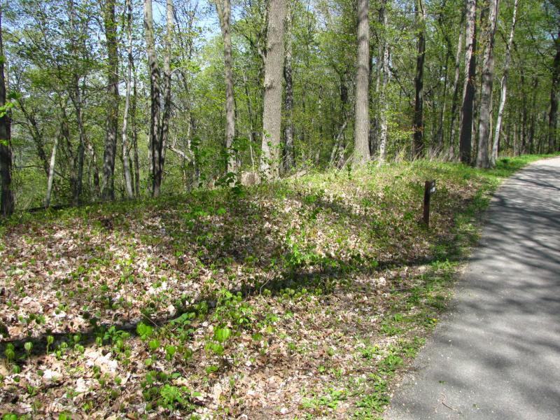
Yet another group of mounds you will find on the park's map is on the Wabasso Ridge just west of the Homestead Campground, called
Robert Glenn Homestead Group. When I visited, there was some brush burning going on at that location - hopefully the first step to
preserve that out-of-the-way cluster of mounds (above).